This technique was born with photography in the middle of the 19th century. Its evolution and wide application permitted a leap forward in different scientific fields.
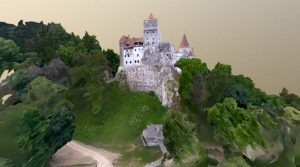
Image source:
https://downloadfree3d.com/3d-models/architecture/building/bran-castle/
What Is Photogrammetry?
Photogrammetry was defined by Wolf and Dewitt as “the science and technology of obtaining reliable information about physical objects and the environment through the process of recording, measuring and interpreting photographic images and patterns of electromagnetic radiant imagery and other phenomena”. Dominique F. Arago conceived the use of photographs to create topographic maps around 1840. Since then, photogrammetry moved from an analog, mechanical technique to a more analytical method based on computer algorithms, digital software and the use of 3D application.
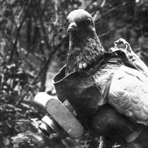
Image source: https://en.wikipedia.org/wiki/Pigeon_photography
Main Applications
There are many variants and usages of photogrammetry. An example is the extraction of 3D models from 2D images, which is useful to determine the distance between two points on a plane and to measure the distance on a scale. This science is known as stereophotogrammetry. Moreover, it is possible to elaborate 3D motions from close-range photogrammetry. Another common use is the extraction from photographs of accurate color ranges and values in representing the characteristics of different materials for a more realistic rendering.
.
Image source:
https://search.creativecommons.org/photos/d1209be9-e864-44e8-9f98-6e76b7bc38aa by nearmap.com
: https://www.flickr.com/photos/nearmap/5545322449/in/photostream/ by nearmap.com
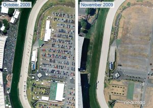
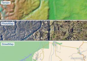
The Mapping Process
Thanks to photomapping we can create a map from a photomosaic, or a composite photographic image of the ground. The process of rectification of imagery is fundamental, and consists of fitting each photograph into a set of four control points. The position of the control points derives from an existing map. Then the scaled photographs are positioned on a grid of control points, and the photomosaic creates a faithful map. This process is possible thanks to aerial photography and data collected by high altitude aircraft and satellites. GoogleEarth, for example, is a product of photomapping.
Image source:
https://www.researchgate.net/figure/a-Photomosaic-of-the-detailed-grid-map-for-Section-2-which-is-nearly-parallel-to-the_fig5_252274486 by Young-Seog Kim
Photogrammetry and Archaeology
Since WWI aerial photography has been used to map and aid archaeological excavations, thanks to photo sources deriving from War Balloons. Today this system is integrated with digital photographs, used with geographic information systems, in order to record excavation exposures. The use in maritime archaeology is increasing, due to the relative ease of mapping sites compared to traditional methods, allowing the creation of 3D maps that can be quickly rendered in virtual reality.
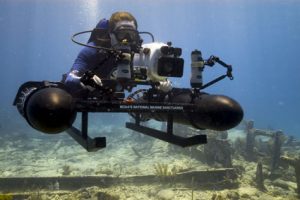
Image source: https://www.flickr.com/photos/usoceangov/3808612993 by NOAA’s National Ocean Service
3D Modeling
This process is similar to those previously described. 3D modeling is based on a data mining process, which starts from scaling the photography into a grid with control points. This is necessary to respect the proportion of the model in reality. Then 3D modeling makes use of advanced rendering software to represent the albedo (the “whiteness”), specular reflection, metallicity, or ambient occlusion of different materials.

Gif source: https://commons.wikimedia.org/wiki/File:Thumbnail_GIF_of_3D_Model_of_Trim_Castle-320×160.gif
video source:https://www.youtube.com/watch?v=1ZBvzKsnh40 by jbdtube
Info source:
https://www.sciencedirect.com/topics/earth-and-planetary-sciences/photogrammetry
https://en.wikipedia.org/wiki/Photogrammetry#cite_note-1
